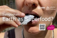
Eating soil is an old and established culturally important practice in many places around the world. In many countries, the action of eating earth and soil-like substances (geophagy) is a means of spiritual cleansing, amongst other benefits. There are even restaurants that serve soil as food. Will soil consumption become more widely accepted or even develop into a ‘superfood’ practice? What would be the implications of this?


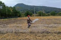

 in Saralanj community in Armenia, is sustainable land management practice described in the WOCAT database. Photo: Kirchmeir, H.")


