New edition of soil property estimates for the world with associated web platform released (SoilGrids250m)
Since the sneak preview on World Soil Day 2019, ISRIC - World Soil Information has been finalizing a new set of soil property maps for the world (SoilGrids250m), incorporating comments from many experts and organizations. Numerous improvements were implemented since publication of the `2017 version’, making this a completely new product. The GIS layers can be accessed using various services. We are particulary pleased with the release of a new webtool with visualization, querying and download facilities for enhanced user experience.
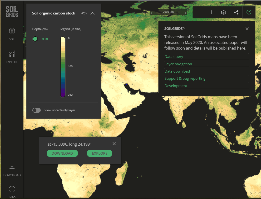
Screenshot of new SoilGrids platform (see https://soilgrids.org/)
Major improvements to SoilGrids include: a) direct coupling with quality-assessed and standardized soil profile (point) data provided by the ISRIC World Soil Information Service (WoSIS), b) an improved selection of covariate layers using Recursive Feature Elimination, c) quantification of uncertainties in the soil predictions, using prediction intervals, through implementation of Quantile Regression Forests, d) adoption of an improved and more realistic cross-validation procedure, and e) use of the Homolosine projection, a modern map projection that minimizes angular and distance distortions simultaneously.
The underpinning soil profiles, some 240,000 of which 196,000 can be accessed freely, were spatially stratified for a robust cross-validation procedure. Based on the distribution of observations across the strata, the following basic properties were selected for global prediction: organic carbon concentration, total nitrogen content, pHwater, cation exchange capacity (measured at pH 7), soil texture (proportion of sand, silt and clay), and volume of coarse fragments.
Predictions are made for six depth intervals as specified by the GlobalSoilMap project (0 - 5 cm, 5 -15 cm, 15 - 30 cm, 30 - 60 cm, 60 - 100 cm, and 100 - 200 cm). A large range of environmental covariates was compiled and edited for the present release; out of this, a set of meaningful covariates was selected for predicting each soil property. This is seen as a substantial refinement to the bulk approach applied in earlier SoilGrids versions. Another major innovation has been the use of the Quantiles Regression Forest algorithm, which allows for quantification of the uncertainty in the predictions.
A first application of the new SoilGrids product has been to calculate and map soil carbon stocks for the world, with financial support from the EU-H2020 CIRCASA project.
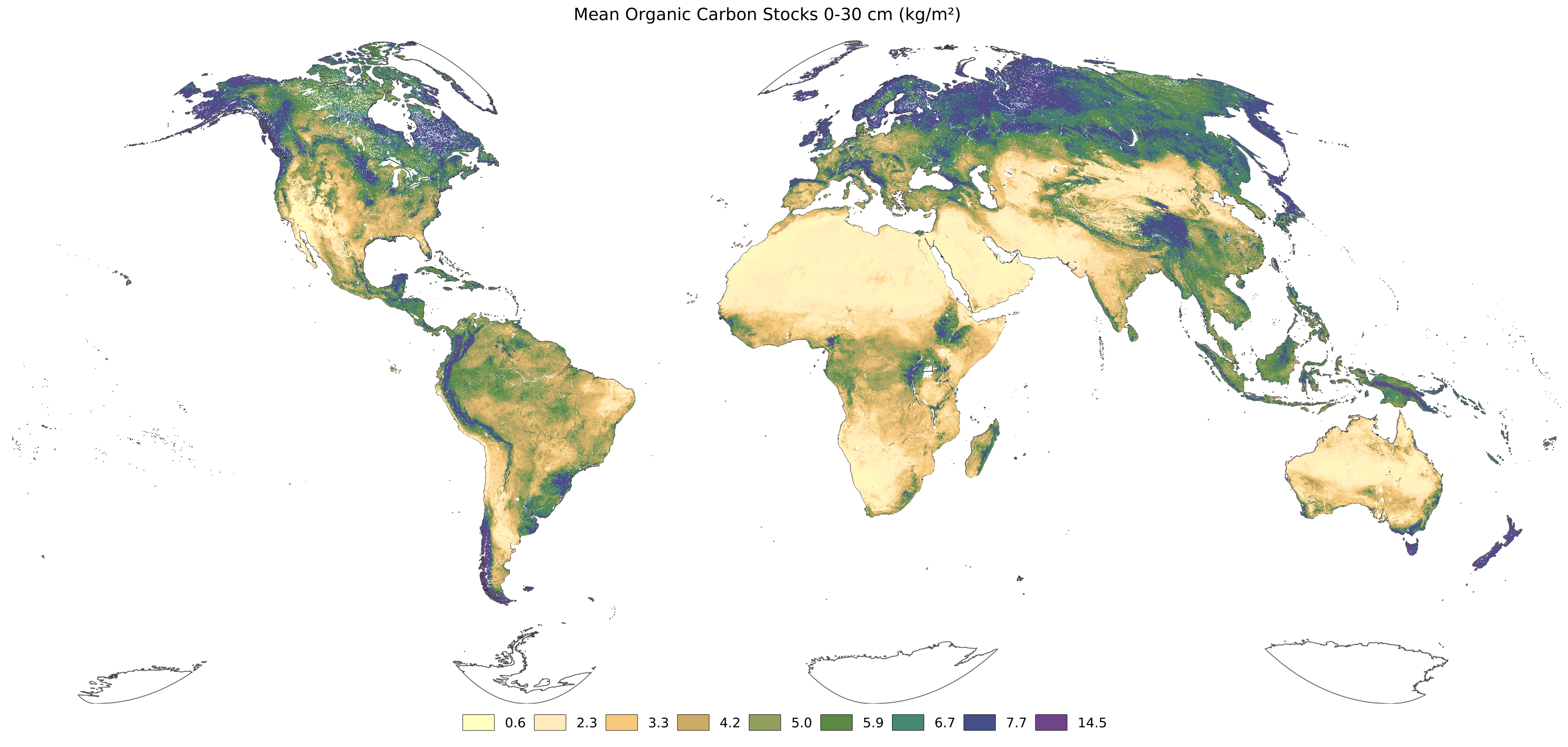
Soil organic carbon stocks (0-30 cm)
Although the GIS layers and underpinning point data have been submitted to both an internal and external expert review, we are aware that there still are some ‘inconsistencies’ in the product. You are most welcome to help us improve SoilGrids by providing your expertise for the geographical areas you are most familiar with, by sending your comments to soilgrids@isric.org. You can also help us consolidate the product by sharing soil profile data and soil expertise for your country.
The WoSIS/SoilGrids effort, which follows a globally consistent approach, complements the activities of the Global Soil Partnership aimed at developing a federated soil information system for the world (GloSIS).