Mapping Land Degradation and Sustainable Land Management is needed for policy makers to make good decision about how and where to make interventions in Sustainable Land Management (SLM).
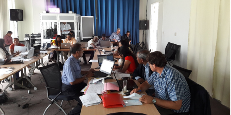
In the context of the World Bank-funded project Land Use Planning for Enhanced Resilience of Landscapes (LAUREL) in Madagascar, a mapping workshop took place from 12-16 February in Antananarivo, with the objective to obtain a national spatial overview of Land Degradation and Sustainable Land Management.
Twelve (high-level) participants from various Malagache institutions attended the workshop. The outcomes are to serve as a standalone result, enabling prioritisation of SLM interventions, as well as being an input into the prototype land use change simulation platform (LANDSIM-P) within the project, to characterize how land use is likely to evolve and to assess the consequences of alternative on the achievement of development objectives and environmental objectives.
The workshop started with a review of the Remote Sensing analysis done at ISRIC – World Soil Information, including changes in vegetation, using NDVI over the period 1981-2015 and changes in NPP over the period 2001-2015. This provided a first impression of potential “hot spots’ and “bright spots” in the country, however without details on the type of degradation or SLM, degree (or effectiveness) causes an impacts. For that reason a mapping exercise following a mapping method based on expert opinion and developed by the World Overview of Conservation Approaches and Technologies (WOCAT) programme, was organised. The experts had to provide a best estimate of the status of degradation or improvement of each mapping unit (delineated based on existing Land cover data, topography and a coarse climate map) and reach consensus about the results.
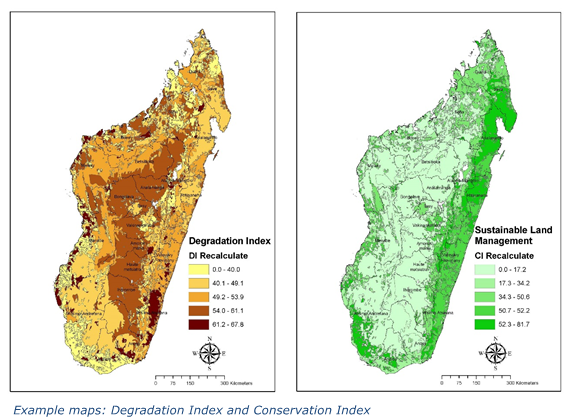
At the end of the workshop information had been filled in for all mapping units representing the study area , and preliminary results could be discussed by the participants to arrive at a consensus on the data. Participants were enthusiastic about the method and about the first Below two composite maps are shown as example outcomes of the workshop: the Degradation Index is a combination of Extent (% of mapping unit affected), Degree (intensity of the degradation process) and Rate (trend over the past 10-15 years), the Conservation Index is its counterpart based on extent, Effectiveness and Trend in effectiveness. They show that for instance the central highlands (mainly consisting of Herbaceous land cover in fairly steep, medium elevation, terrain), have a relatively high score for Degradation and low for Conservation, which could be criteria to prioritise this are for SLM interventions.
Further study in selected sites will be performed to provide more accurate advice.


