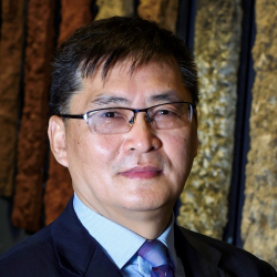
Zhanguo
Bai
Zhanguo
Bai
Zhanguo is an expert in integrated soil, land, and water management. He specialises in assessing soil/land degradation and conservation using GIS, remote sensing, and environmental tracers.
Zhanguo has been actively involved in developing the World Overview of Conservation Approaches and Technology (WOCAT), a global network of knowledge and database dedicated to sustainable land management (SLM).
Throughout his career, Zhanguo has taken up various projects and initiatives related to land conservation and management. Some of the notable projects he was responsible for include the GEF/UNEP/FAO project Global Assessment of Land Degradation and Improvement (GLADA), the World Bank-funded project Land Degradation & Risk Mapping in Turkey (TULADA), the Netherlands PVW-funded project Green Water Management & Credits for China (GWC-China) and the IFAD-funded project Green Water Credits in Kenya(GWC-Kenya).
He has also worked on other projects such as the EU FP-7 project Desertification Mitigation and Remediation of Land (DESIRE), EU FP-7 project Preventing and Remediating Degradation of Soils in Europe through Land Care (RECARE), EU Horizon2020 project Interactive Soil Quality Assessment in Europe and China for Agricultural Productivity and Environmental Resilience (iSQAPER), World Bank-funded project Land Use Planning for Enhanced Resilience of Landscapes for Madagascar (LAUREL) and EU project Chittagong Hill Tracts Improved Natural Resources Management, Bangladesh (CHARM). He has also contributed to the Netherlands Environmental Assessment Agency (PBL) project Biodiversity, Ecosystem Services and Development to map global soil degradation.
More recently, Zhanguo leads the joint ISRIC-UCAS-AGIS funded Project: Sequencing World Soil DNA with Archived Soil Samples; co-leads the EU DeSIRA and Italian Government jointly funded Project: Climate Smart WATer Management and Sustainable DEVelopment for Food and Agriculture in East Africa (WATDEV), and is involving in the EU DeSIRA and the Netherlands Government jointly funded Project: Land, Soil and Crop Information Services (LSC-IS) to support Climate-Smart Agriculture as well as EU Horizon-2020 funded Project: Platform for Helping small and medium farmers to Incorporate digital Technology for equal Opportunities (PHITO).
Zhanguo has published 59 peer-reviewed papers, 9 book chapters, 12 reviewed abstracts in proceedings, and 30 technical reports.