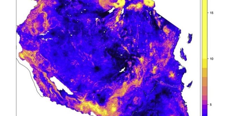
Soil organic carbon maps to support Tanzania UN-REDD strategies
Countries require up to date soil organic carbon (SOC) inventories to support carbon monitoring for REDD+ under the UNCCD as well as reporting on greenhouse gas emissions under the UNFCCC.
ISRIC produced soil organic carbon maps for Tanzania in collaboration with Tanzania Forest Services, Sokoine University of Agriculture, the African Soil Information Service (AfSIS) and the FAO.
Maps were developed from a large set of soil samples collected under the National Forest Resources Monitoring and Assessment (NAFORMA) programme and remote sensing imagery. The SOC maps provide new insights in the soil organic carbon pool and supplement findings on the aboveground carbon assessment of the NAFORMA programme.
Effects of modelling uncertainty on SOC stock assessment (0-30 cm) for Tanzania are discussed in a paper published in Geoderma.
Citation:
Kempen, B., Dalsgaard, S., Kaaya, A.K., Chamuya, N., Ruipérez-González, M., Pekkarinen, A., Walsh, M.G., 2019. Mapping topsoil organic carbon concentrations and stocks for Tanzania. Geoderma 337, 164-180. https://doi.org/10.1016/j.geoderma.2018.09.011
