Hands-on Digital Soil Mapping 2021
Five-day course from Monday 17 May to Friday 21 May 2021
The course will be given on-line this year, which has had some implications for the programme. We will have longer lunch breaks and shorter days, because on-line learning is more tiresome than on-site learning.
Overview | Who is it for? | Software installation | Programme | Materials
 |
 |
Overview
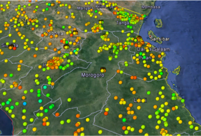
This course introduces methods and software for management, analysis and mapping of soil type and soil properties within the R environment for statistical computing. The course alternates between lectures and computer exercises and covers a variety of subjects, such as geostatistics, machine learning for soil mapping, soil functional mapping, proximal soil sensing, quantification of uncertainty, sampling for mapping and statistical validation. The course aims at soil geographers and environmental scientists who want to learn more about the theory and practice of digital soil mapping. After this course, participants will be able to apply the methods learnt to their own datasets. Lecturers are experienced pedometricians and soil data analysis specialists.
-
Gerard Heuvelink, course coordinator (geostatistics, uncertainty quantification)
-
Fenny van Egmond (remote and proximal soil sensing)
-
Bas Kempen (data preparation, machine learning)
-
Johan Leenaars (mapping plant-available soil water and nutrients)
-
Laura Poggio (data preparation, machine learning)
-
Maria Ruiperez Gonzalez (mapping plant-available soil water and nutrients)
-
Stephan Mantel (virtual visit World Soil Museum)
-
David Rossiter (geostatistics, data preparation, sampling for statistical validation, guest lecture)
-
Titia Mulder, guest lecturer (remote and proximal soil sensing)
-
Dick Brus, guest lecturer (sampling for statistical validation)
Fees
The registration fee covers the costs of all course materials, lectures and online teaching resources. This course is organized on a cost-recovery basis i.e. no profit is made from the course fees. Upon completing the course, participants will receive a certificate and free access to software and datasets used during the course. For information about the fees:
https://www.isric.org/utilise/capacity-building/springschool/costs-and-payment
Who is it for?
This course is intended for soil and environmental professionals, researchers and PhD-students interested in producing soil maps and/or using local, regional and global soil datasets for digital soil mapping. Participants must have a basic level of statistics, geo-information science and soil/environmental science. Experience with computer programming in R is advantageous but not required. Those not familiar with R will be asked to run a self-study tutorial prior to the course. A number of recorded sessions from a previous Spring School can be accessed via the ISRIC YouTube channel at: http://youtube.com/c/ISRICorg.
Software installation
Please note that to participate in the DSM course you need to install R and RStudio software prior to the course. Software installation instructions can be found here, and the associated R code to test your installation here. Please read and follow these carefully to ensure you are fully prepared to the Spring School.
Programme
All times are Central European Summer Time zone (CEST), that is UTC+2.
DAY 1 (Monday, 17 May 2021)
| Time | Topic | Type | Lecturer |
| 9.00 – 9.30 | Opening, welcome by ISRIC director Rik van den Bosch, course introduction and overview | Lecture | Gerard Heuvelink |
| 9.30 – 10.30 | Geostatistics for soil mapping | Lecture | Gerard Heuvelink |
| 10.30 – 11.00 | Morning break | ||
| 11.00 – 12.30 | Geostatistics for soil mapping | Lecture | Gerard Heuvelink |
| 12.30 – 14.00 | Lunch | ||
| 14.00 – 15.30 | Geostatistics for soil mapping | Computer practical |
Gerard Heuvelink David Rossiter |
| 15.30 – 16.00 | Afternoon break | ||
| 16.00 – 17.00 | Geostatistics for soil mapping |
Computer practical and feedback |
Gerard Heuvelink David Rossiter |
DAY 2 (Tuesday, 18 May 2021)
|
Block |
Topic |
Type |
Lecturer |
|
9.00 – 10.30 |
Geostatistics for soil mapping |
Lecture |
Gerard Heuvelink |
| 10.30 – 11.00 | Morning break | ||
| 11.00 – 12.30 | Soil and covariate data preparation | Lecture | Bas Kempen |
| 12.30 – 14.00 | Lunch | ||
|
14.00 – 15.30 |
Soil and covariate data preparation |
Lecture & computer practical |
Bas Kempen Laura Poggio David Rossiter |
|
15.30 – 16.00 |
Afternoon break |
|
|
| 16.00 – 17.00 | Soil and covariate data preparation |
Computer practical and feedback |
Bas Kempen Laura Poggio David Rossiter |
DAY 3 (Wednesday, 19 May 2021)
|
Block |
Topic |
Type |
Lecturer |
| 9.00 – 10.30 | Remote and proximal soil sensing | Lecture | Titia Mulder |
|
10.30 – 11.00 |
Morning break |
||
|
11.00 – 12.30 |
Remote and proximal soil sensing |
Computer practical and feedback |
Titia Mulder Fenny van Egmond |
|
12.30 – 14.00 |
Lunch |
||
|
14.00 – 15.30 |
Machine learning for soil mapping |
Lecture |
Bas Kempen |
|
15:30 – 16.30 |
Afternoon Break |
||
|
15.30 – 17.00 |
Machine learning for soil mapping |
Computer practical |
Bas Kempen Laura Poggio |
DAY 4 (Thursday, 20 May 2021)
|
Block |
Topic |
Type |
Lecturer |
|
9.00 – 10.30 |
Machine learning for soil mapping |
Computer practical and feedback |
Bas Kempen Laura Poggio |
|
10.30 – 11.00 |
Morning break |
||
|
11.00 – 12.30 |
Sampling for statistical validation |
Lecture |
Dick Brus |
|
12.30 – 14.00 |
Lunch |
||
|
14.00 – 15.30 |
Sampling for statistical validation |
Lecture & computer practical |
Dick Brus David Rossiter |
|
15.30 – 16.00 |
Afternoon break |
||
|
16.00 – 17.00 |
Sampling for statistical validation |
Computer practical and feedback |
Dick Brus David Rossiter |
DAY 5 (Friday, 21 May 2021)
|
Block |
Topic |
Type |
Lecturer |
|
9.00 – 10.30 |
Mapping plant-available soil water and nutrients |
Lecture and computer practical |
Johan Leenaars |
|
10.30 – 11.00 |
Morning break |
||
|
11.00 – 12.30 |
Mapping plant-available soil water and nutrients |
Computer practical and feedback |
Johan Leenaars Maria Ruiperez-Gonzalez |
|
12.30 – 14.00 |
Lunch |
||
| 14.00 – 14.40 | Virtual excursion World Soil Museum | Stephan Mantel | |
|
14.40 – 15.00 |
Course evaluation and certificates |
|
Gerard Heuvelink |
| 15.00 – 15.15 | Afternoon break | ||
| 15.15 – 16.15 | Valuing the soil resource | Invited lecture | David Rossiter |
|
16.15 – 16.30 |
Closing words |
|
Gerard Heuvelink |
Materials
You must use your own computer or laptop and have recent releases of R and RStudio installed (see above). Participants receive all workshop materials (test datasets, R scripts, lecture slides, tutorials) during the workshop.