
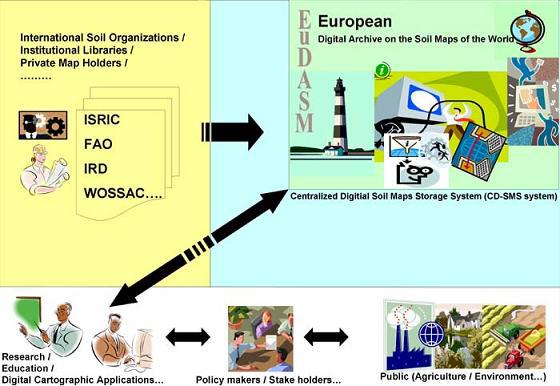
Realizing the need to conserve the information on existing maps, which underpin the fast-developing thematic mapping strategies to support soil protection, the Institute of Environment and Sustainability (IES) in the European Commission (Italy) and ISRIC — World Soil Information initiated the European Digital Archive of Soil Maps (EuDASM). The immediate objective is to transfer soil information into digital format, with the maximum resolution possible, to preserve the information of paper maps that are vulnerable to deterioration.
EuDASM - European Digital Archive of Soil Maps
ISRIC
Project start
2004
Project end
2009
EuDASM provides access to an on-line collection of soil and related maps for Africa, Asia, Canada, Europe, Latin America and the Caribbean, and the United States of America.; all maps were scanned in high-resolution. The EuDASM collection, plus newer additions, may be consulted on-line through the ISRIC - World Soil Library. For this, you are advised to select the "Country" or the "Continent" (Filter) for the country/region of interest and then to browse the available, zoomable HR maps ( (document type= map).