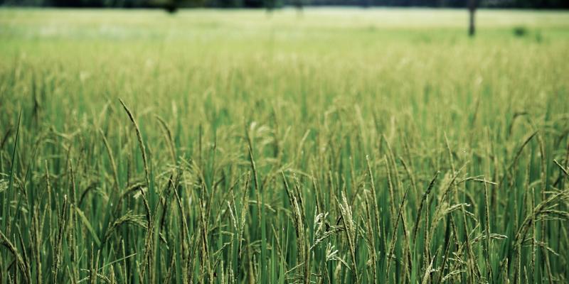
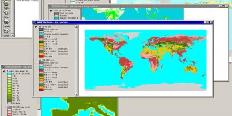
Share on: Completed projects TAPESTRIES project Ethiopia Start year 2019 End year 2023 Read more Space-time Statistical Modelling of Soil Organic Carbon Start year 2018 End year 2021 Read more Soil and terrain database for the Danube basin Start year 2019 End year 2021 Read more Building a Soil Intelligence System for India Start year 2018 End year 2021 Read more Interactive Soil Quality Assessment in Europe and China for Agricultural Productivity and Environmental Resilience (iSQAPER) Start year 2015 End year 2020 Read more REALISE - survey and mapping of soil resources Start year 2019 End year 2020 Read more Spatiotemporal sufficiency of water and nutrients for major crops in Burkina Faso Start year 2020 End year 2020 Read more LAUREL (Land Use Planning for Enhanced Resilience of Landscapes) Start year 2017 End year 2019 Read more Marginal lands for Growing Industrial Crops ( MAGIC) Start year 2017 End year 2019 Read more SOiL EXploration and Sampling for Science and Education (SOLEX) Start year 2011 End year 2018 Read more Preventing and Remediating Degradation of Soils in Europe through Land Care (RECARE) Start year 2013 End year 2018 Read more Enhancing rice markets in Uganda through smart micronutrient fertilization (ENRICH) Start year 2016 End year 2018 Read more Developing baselines for Land Degradation Neutrality target setting in Namibia Start year 2016 End year 2017 Read more Contributions to Policy Report PBL for Global Land Outlook Start year 2016 End year 2017 Read more Soil nutrient maps of Sub-Saharan Africa at 250 m resolution Start year 2016 End year 2017 Read more Taking fertilizer recommendations to scale for major crops in West Africa Start year 2017 End year 2017 Read more Africa Soil Information Service (AfSIS) Start year 2009 End year 2016 Read more World Inventory of Soil Emission Potentials (WISE) Start year 1991 End year 2016 Read more Capacity building for scaling up of evidence-based best practices in agricultural production in Ethiopia (CASCAPE) Start year 2013 End year 2016 Read more Soil and Terrain (SOTER) database programme Start year 1986 End year 2016 Read more Green Water Credits (GWC) Start year 2006 End year 2016 Read more Geospatial Farm Fertilizer Analysis Start year 2014 End year 2015 Read more Grasslands, rangelands, livestock and climate resilient mitigation (Africa) Start year 2014 End year 2015 Read more Benefits of Soil Carbon (BSC-SCOPE) Start year 2013 End year 2014 Read more Modelling of soil degradation and its impact on ecosystem services globally Start year 2010 End year 2013 Read more GlobalSoilMap.Net Start year 2009 End year 2013 Read more Carbon mapping Tanzania Start year 2013 End year 2013 Read more Soil Atlas of Africa Start year 2009 End year 2013 Read more Carbon Benefits Project: Modelling, Measurement and Monitoring (GEF-CPB) Start year 2009 End year 2013 Read more Global Earth Observing System (GEOSS) Start year 2010 End year 2013 Read more Land Degradation Assessment in the Chaco, Argentina Start year 2011 End year 2012 Read more Verrijst Start year 2010 End year 2012 Read more Global DEM interoperability Start year 2011 End year 2012 Read more Calculating productivity loss due to land degradation Start year 2010 End year 2012 Read more Desertification Mitigation and Remediation of Land (DESIRE) Start year 2007 End year 2012 Read more e-SOTER Start year 2008 End year 2012 Read more Global assessment of soil phosphorus retention potential Start year 2011 End year 2011 Read more Land Degradation and Risk Mapping in Turkey (TULADA) Start year 2010 End year 2011 Read more Overview of soil phosphorus data from a large international soil database Start year 2010 End year 2011 Read more EuDASM - European Digital Archive of Soil Maps Start year 2004 End year 2009 Read more Global Assessment of Land Degradation and Improvement (GLADA) Start year 2006 End year 2009 Read more Land Degradation Assessment for Dryland Areas (LADA) Start year 2006 End year 2009 Read more Global Environmental Outlook4 (GEO4) Start year 2005 End year 2007 Read more Chittagong Hill Tracts Improved Natural Resources Management (CHARM) Start year 2005 End year 2007 Read more Soil and water protection in Northern and Western Europe (SOWAP) Start year 2004 End year 2006 Read more Kalimantan project Start year 2006 End year 2006 Read more Carbon Sequestration Project (CSEQ) Start year 2005 End year 2006 Read more Harmonized continental SOTER-derived database (SOTWIS) Start year 2005 End year 2005 Read more Soil Organic Carbon Stocks and Changes (GEF-SOC) Start year 2002 End year 2005 Read more Impact of desertification on food security in southern Africa: a case study for Zimbabwe (ZILRIS) Start year 2000 End year 2004 Read more Berau Forest Management Project (BFMP) Start year 2002 End year 2003 Read more PAN-European Soil Erosion Risk Assessment (PESERA) Start year 2000 End year 2003 Read more Mapping of soil and terrain vulnerability in Central and Eastern Europe (SOVEUR) Start year 1997 End year 2000 Read more Pilot Analysis of Global Ecosystems (PAGE) Start year 1999 End year 2000 Read more Management options for increased soil carbon sequestration (SOC-NOP) Start year 1998 End year 1999 Read more Scaling of trace gas fluxes (SCALING) Start year 1997 End year 1998 Read more Soil parameter estimates for the soil types of the world for use in global and regional modelling (WISE-IFPRI study) Start year 1997 End year 1997 Read more Assessment of Soil Degradation in South and Southeast Asia (ASSOD) Start year 1995 End year 1997 Read more Global Environment Outlook 1 (GEO1) Start year 1995 End year 1996 Read more Ethno-Pedological studies in Ghana, Peru and the Philippines (ILEIA) Start year 1995 End year 1996 Read more Establishment of National Soil Reference Collections (NASREC) Start year 1980 End year 1995 Read more Global Assessment of Human-induced Soil Degradation (GLASOD) Start year 1988 End year 1991 Read more Laboratory methods and data exchange (LABEX) Start year 1980 End year 1990 Read more Ongoing projects Ongoing projects can be found here.
 Chernozem soil.")

")
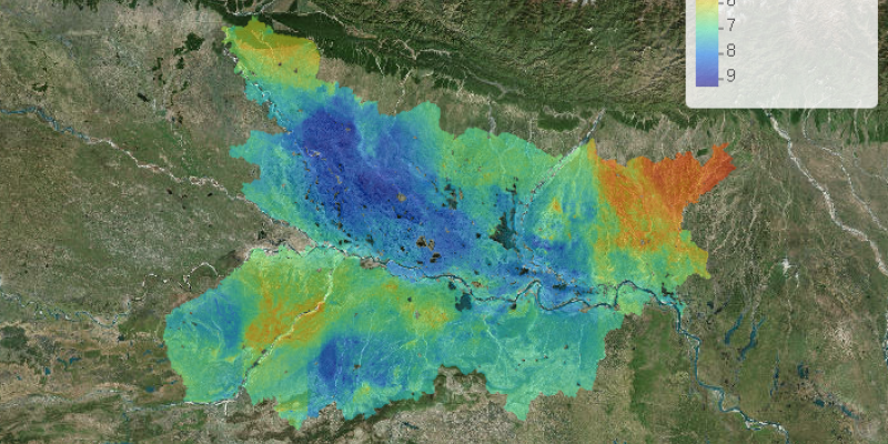
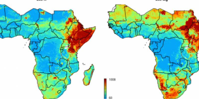
 from the long-term average of the relative P sufficiency for sorghum")
")
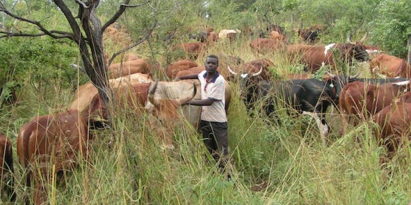
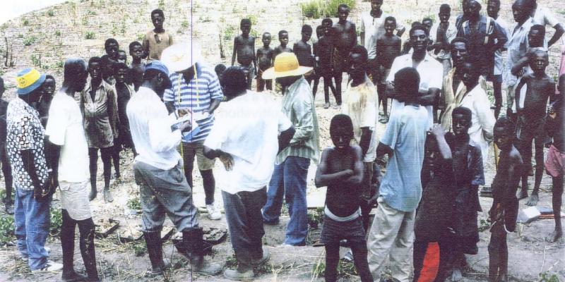
. Image: ISRIC")

")


")


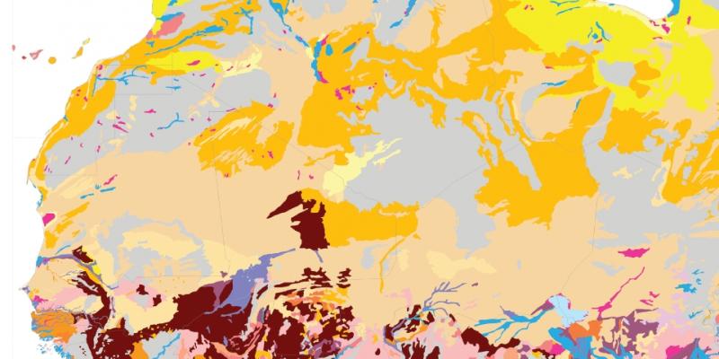
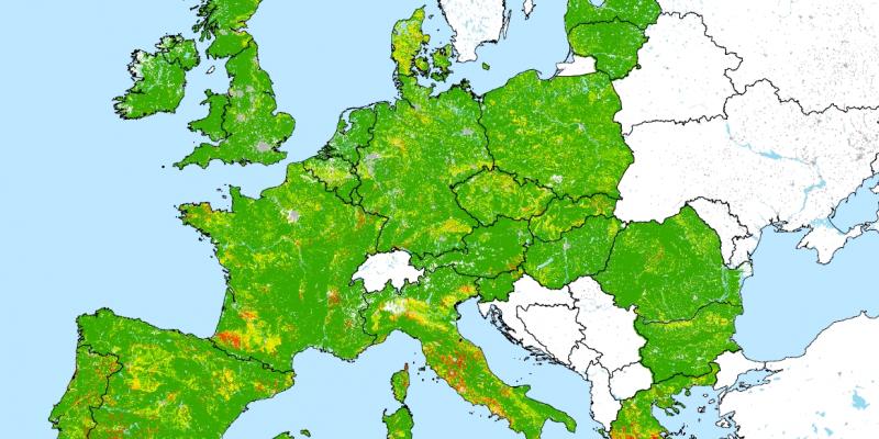
 of the Central European window")


")

")

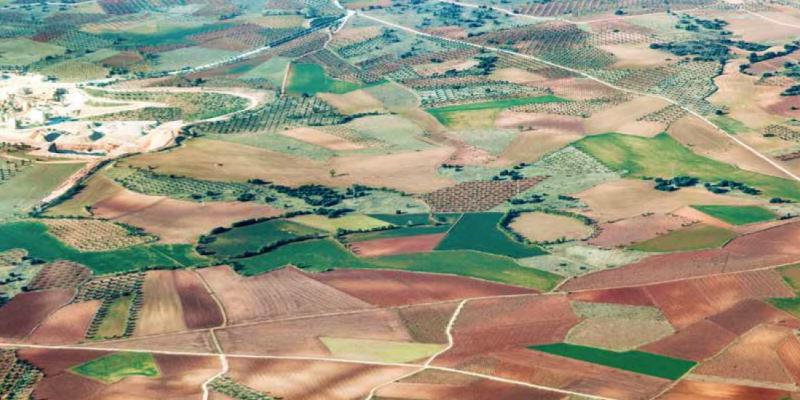
. Credit: Josep Miquel Ubalde")


")