Trusted soil data for solving global issues
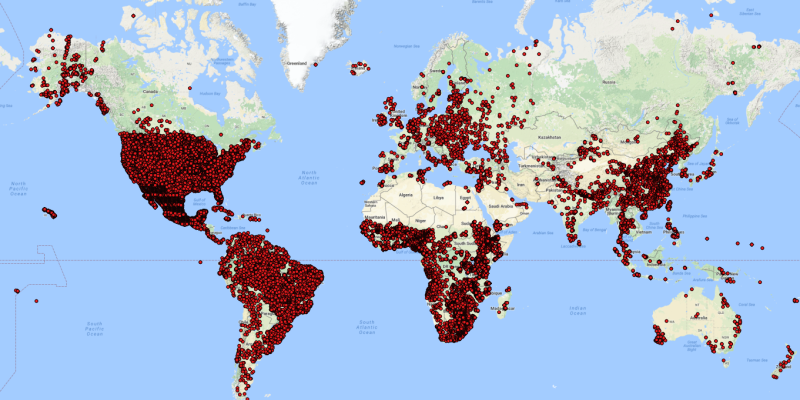
ISRIC has released a large set of standardised soil profile data for the world. It contains 4 million records for some 94 thousand profiles. The data are freely available from our website.
The data come from various sources. The provenance and licence strongly determined which data could be standardised and subsequently served to the international community.
Procedures for obtaining, checking, standardising, and serving the various source data were published in Earth System Science Data (17 February 2017), an open-access journal.
Special attention was paid to the selection of soil analytical and physical properties considered in the GlobalSoilMap specifications: organic carbon, soil pH, soil texture (sand, silt, and clay), coarse fragments (> 2 mm), cation exchange capacity, electrical conductivity, bulk density, and water holding capacity.
The data can be used to underpin broad-scale mapping and modelling efforts aimed at addressing issues such as food security, land degradation, and climate change.
Many data providers have already contributed to this global effort. Yet, there are still important soil geographical and soil taxonomical gaps in the present dataset (snapshot).
The number of soil profiles and range of soil properties managed in and served from our central server database (WoSIS, World Soil Information Service) will only grow with broader participation.
Please contact us if you wish to contribute some of your soil profile data to this international effort.
