Background
The CASCAPE project is a joint effort of Ethiopia and The Netherlands to improve agricultural productivity in Ethiopia. CASCAPE was designed for Capacity building for scaling up of evidence-based best practices in agricultural production in Ethiopia and is executed in close cooperation with the Agricultural Growth Programme (AGP) of the Ethiopian government. ALTERRA (www.wageningenur.nl/en) coordinates the implementation of the project on behalf of Wageningen University and Research centre (WUR) and the project is coordinated at national level by the National Coordination Unit and executed with various partners in 6 regional clusters with interventions in 30 woredas ('districts').
 A soil characterisation & mapping study was initiated to generate coherent information on the soil-landscape resources of the CASCAPE intervention woredas in support to scaling up of best practices in agricultural soil fertility and soil water management. ISRIC - World Soil Information was contracted by ALTERRA to provide technical and scientific assistance and expert advice. The study resulted in coherent data and information on the characteristics and distribution of soil resources in the landscapes of the 30 intervention woredas.
Executive Summary
The objective of this study is to produce a dataset of the major soil-landscape resources of the Cascape intervention woredas. The Cascape project operates in thirty woredas, located in six regions, therewith contributing to the Agricultural Growth Program of the Ethiopian Government in general and to the ‘Soil fertility roadmap’ in particular. To achieve the objective of the study, a collaborative project was established among Cascape project partners with scientists from ISRIC - World Soil Information (ICSU World Data Centre for Soils), the Cascape project’s National Coordination Unit in partnership with universities from six regions in Ethiopia (Addis Ababa, Bahir Dar, Haramaya, Hawassa, Jimma, Mekelle) and ALTERRA(Wageningen UR).
Geospatially explicit information on the major soil resources in the landscapes of Ethiopia is lacking or fragmented for much of the country and yet this information, locally observed and validated and nationally harmonised and consistent, is key for understanding the country’s soils and their qualities as coherent support, complementary to soil fertility mapping as first reported for Ethiopia by Murphy (1959) or complementary to ISRIC SoilGrids, to scaling up of evidence-based best practices in the agricultural growth program of the country.
The study started with a survey to identify and characterise the major soil types of the agricultural lands of a number of four kebeles selected for each of the 30 woreda. Soil profiles were georeferenced and described in the field and samples were taken, from depth intervals till beyond root zone depth of a selection of profiles, and analysed in the laboratory. The generated soil profile data were compiled in a database and the profiles were classified to soil reference groups, including qualifiers, according to the framework of the World Reference Base (WRB).
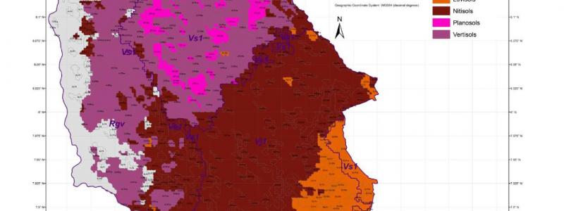
Using the soil profile data combined with spatial covariate data, the relationships between soil types and landscapes at kebele level were quantified statistically with Random Forests modelling to produce a soil-landscape map at woreda level. The map depicts the reference soil group, with a prefix-qualifier, predicted as most probable at given locations, aggregated to polygons according to geomorphology and landscape facets.
The map was validated at woreda level using additional soil profile data, also classified according to WRB, which were augered beyond the kebele level. Combining áll soil profile data, the soil-landscape relationships were modelled at woreda level to produce a final version of the map including a final round of validation. Map purity of the final raster product at a resolution of 250 m, is approximately 50% and is estimated as 40% when generalised to a polygon version of the map. The map purity is 60 and 50%, respectively, with the classification aggregated to the reference soil group.
The dataset, including soil profile data and soil-landscape resource maps, is available for download at the FTP server, through the link given in the column at the right, under the license of Creative Commons Attribution 4.0 international (CC-BY 4.0) as specified at: http://creativecommons.org/licenses/by/4.0/.
For attribution, please cite: J.G.B. Leenaars, E. Eyasu, H. Wösten, M. Ruiperez González, B. Kempen, A. Ashenafi, F. Brouwer, 2016. Major soil-landscape resources of the Cascape intervention woredas, Ethiopia. Soil information in support to scaling up of evidence-based best practices in agriculktural production (with dataset). CASCAPE working paper series OT_CP_2016_1. 380 p.
Keywords: soil data, soil profile, soil map, soil survey, soil landscape, soil resources, WRB, Random Forests, Ethiopia, Africa.