")
ISRIC—World Soil Information is compiling legacy soil profile data for Sub-Saharan Africa, as a project activity of the Globally integrated-Africa Soil Information Service (AfSIS) project; http://africasoils.net/services/data/soil-databases/.
The Africa Soil Profiles Database (AfSP) holds 1000's of unique soil profile records, inventoried and compiled from a wide variety of data sources and originating from studies covering the near entire continent, of which over 90% is georeferenced. All records include soil profile layer attribute data and over 80% of the records includes soil analytical data including, but not limited to, those specified by GlobalSoilMap.net. Soil attribute values are standardized according to e-SOTER conventions and validated according to routine rules. Odd values are flagged. The degree of validation, and associated reliability of the data, varies because reference soil profile data, that are previously and thoroughly validated, are compiled together with non-reference soil profile data of lesser inherent representativeness.
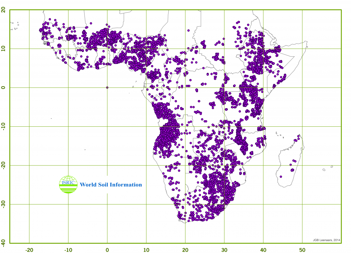
Graphical representation of data points in the Africa Soil Profile Database (AfSP)
The database is continuously updated and growing and milestone versions have been posted online and made available to the project and the public. The dataset will also be through the World Soil Information Service.
The soil profile data serve various purposes and in the AfSIS project particularly as input to the soil property maps generated and released by AfSIS. Derived from these soil property maps, together with the GYGA project, is functional soil information (maps) on the root zone plant-available water holding capacity.