Standards
ISRIC has a mission to "serve the international community with information about the world’s soil resources to help addressing major global issues." This process involves all stages of the data life cycle from data sampling in the field and laboratory analyses to collation into quality-assessed databases followed by data standardisation, analysis, modelling, and publication of the data. With partners, we are working towards the maintenance and development of new, internationally, recognised standards for handling and interpreting soil data.
We are proactive in working groups of the International Union of Soil Science (IUSS), the Open Geospatial Consortium (OGC), the Global Soil Partnership, and member of the CoreTrustSeal Trustworthy Data Repositories assembly of reviewers.
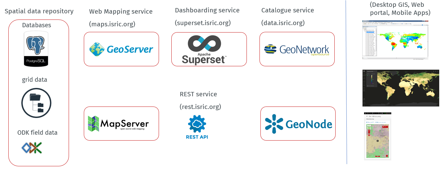
Ultimately, as indicated by RDA-CODATA, the ‘ability of the research community to share, access, and reuse data, as well as to integrate data from diverse sources for research, education, and other purposes requires effective technical, syntactic, semantic, and legal interoperability rules and practices’. An important aspect here is that data should comply with FAIR principles; they should be ‘Findable, Accessible, Interoperable, and Reusable’. Our spatial data infrastructure (SDI) follows open source standards.
Main procedures and standards in use at ISRIC are described in a technical report. For ease of reference, we also maintain an overview of 'internationally' accepted standards in the soil domain (click here).
